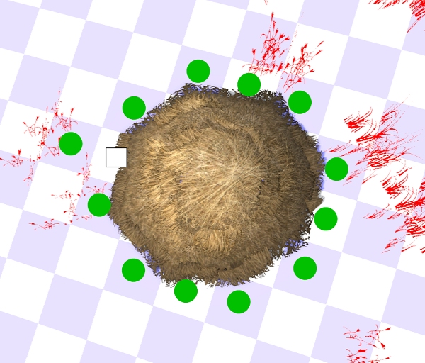
Anyone have an answer for this? COH2 maps are broken down into 2 dimensional arrays with each element representing 1 meter of space. I am not sure of any tools that show how cover is calculated but here is the strange result of this object.
I moused around the object and found that one cell is NOT green cover. This spot will now forever be called the Sturmpanther spot
As Ferwiner suggested, we should always take the time to look at the cover spot indicators on the terrain.
It appears that the object cover is calculated from a circle and this object is off center from the grid. So there is a single cell visible that is "inside" the circle and is not considered to be cover.
The problem is that the IMPASS calculations must be different from the cover calculations. If they both used the same circle for calculations, the Sturmpanther Spot™ would be considered impassable and you could not move into it.
[news voice] We will be bringing you updates as this mystery unfolds...[/news voice]
Well done!


 Germany


 I just gave him all possible steps he can go for. I have now since 1 year no bugsplit anymore. FeelsGoodMan
 nerbo
nerbo
 SoE-Sturmpanther-


