WorldBuilder TotW #3: Pathfinding with the Ruler
Welcome back once more, ladies and gents, to the WorldBuilder tip of the week. This week, we over at COH2.org will be continuing to provide you with small hints and tips to use in WorldBuilder, to improve and ease your mapping experience!
In this week’s TotW we’re looking into Pathfinding, using the Ruler Tool. Although this isn’t a necessary tool, it’s certainly a useful one to use for testing your map before release.
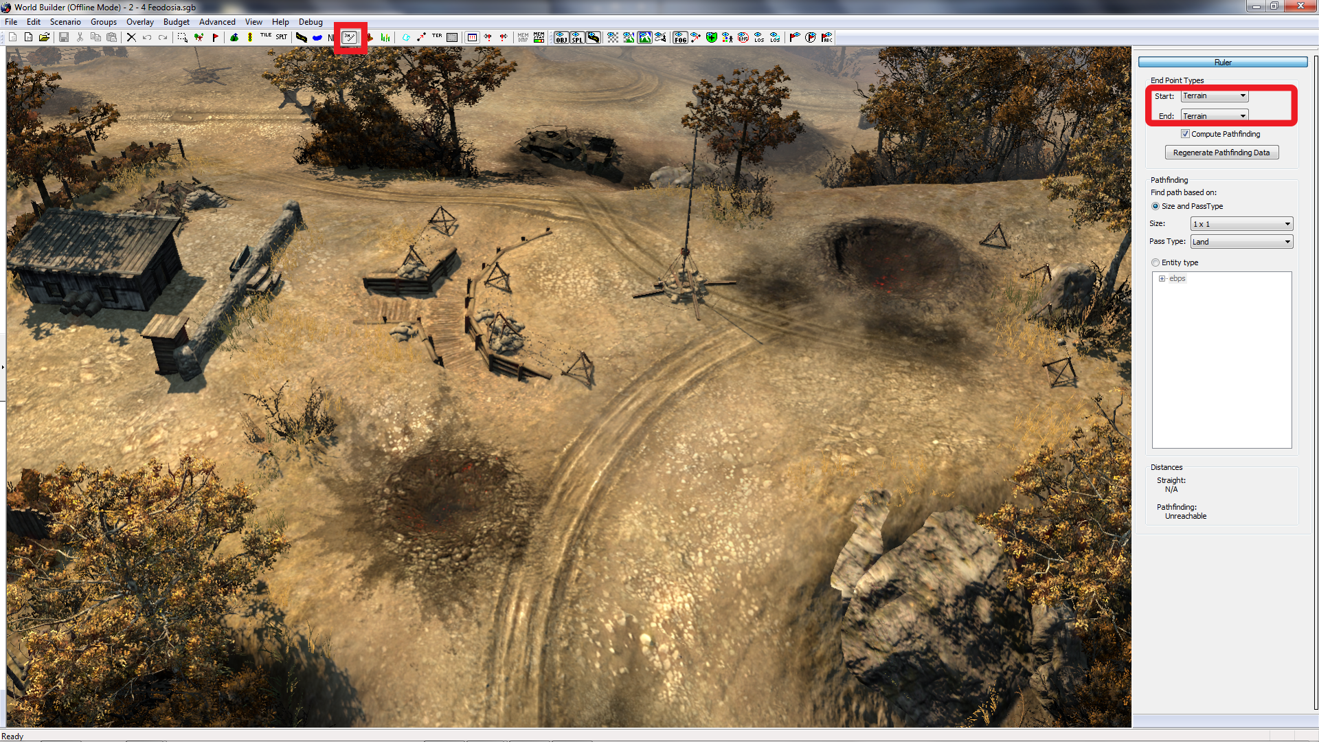
The Ruler Tool, as the name suggests, is used for measuring gaps between objects. By selecting the “Start” and “End” point types as Terrain (See Figure 2), you can left-click on any area of ground one to set a point, and left-click once more to calculate the distance between the two (See Figure 3).
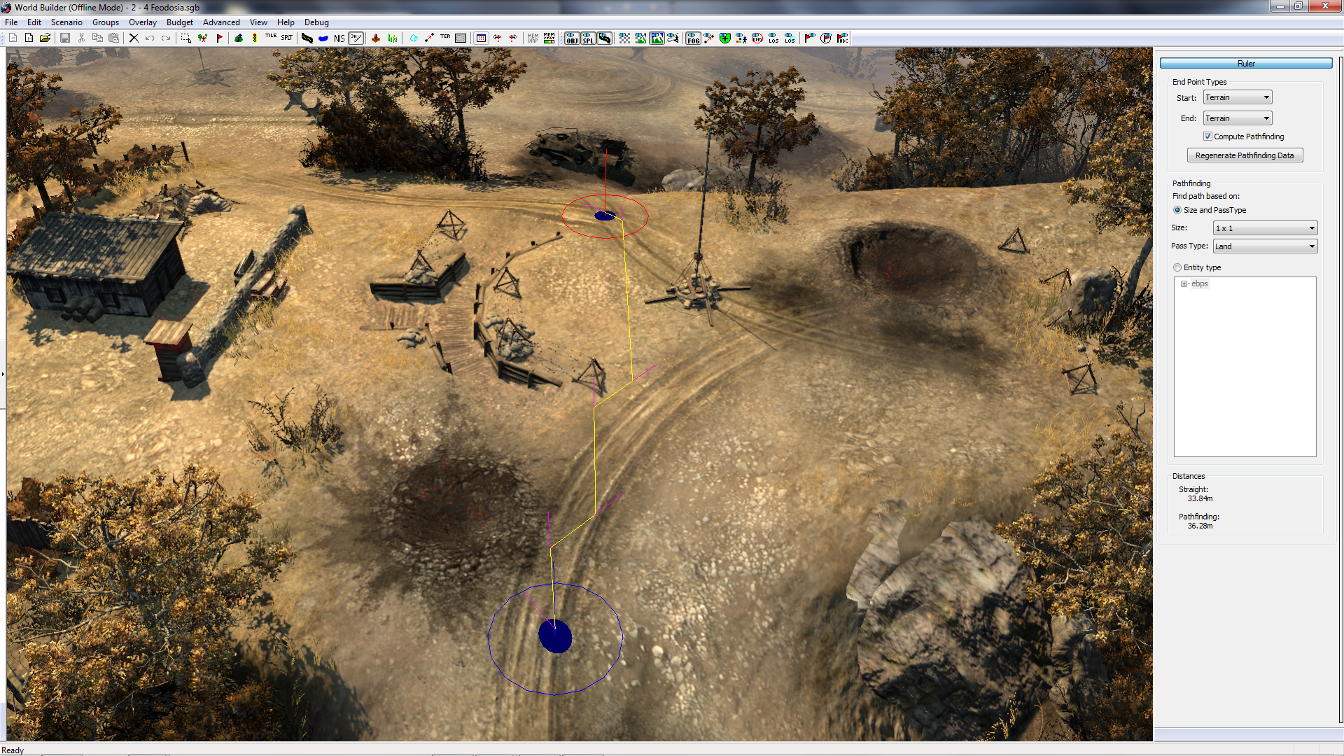
By clicking and dragging the Ruler window down, you will see your results at the bottom of the window, calculated in metres.
Additionally, by checking the “Compute Pathfinding” option, an additional result will be calculated, telling you the quickest distance between the two points (See Figure 4).
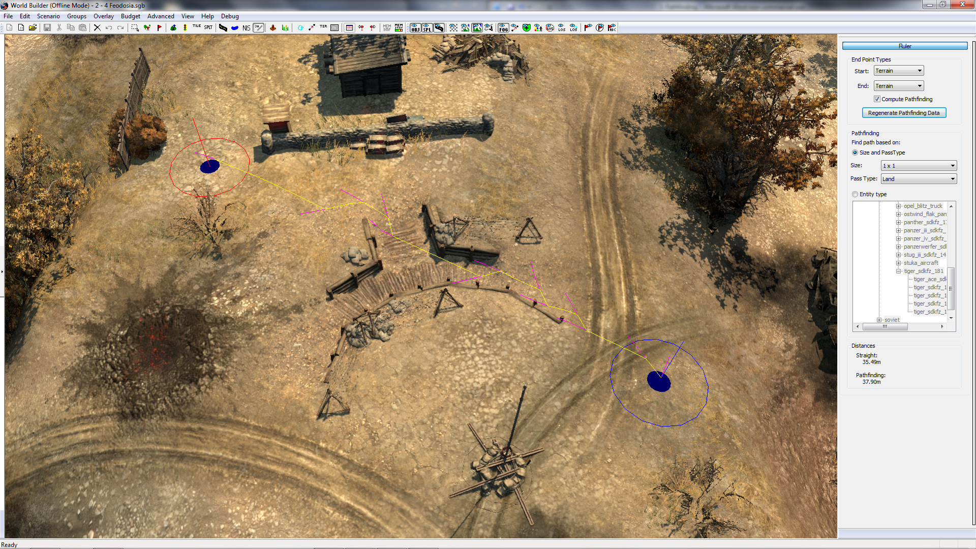
With this option selected, there will also be a visual result shown on the map itself, where a line (which otherwise will not be there) will show the route that units will have to take, easily showing you the ideal route that infantry will take from A to B (See Figure 5).
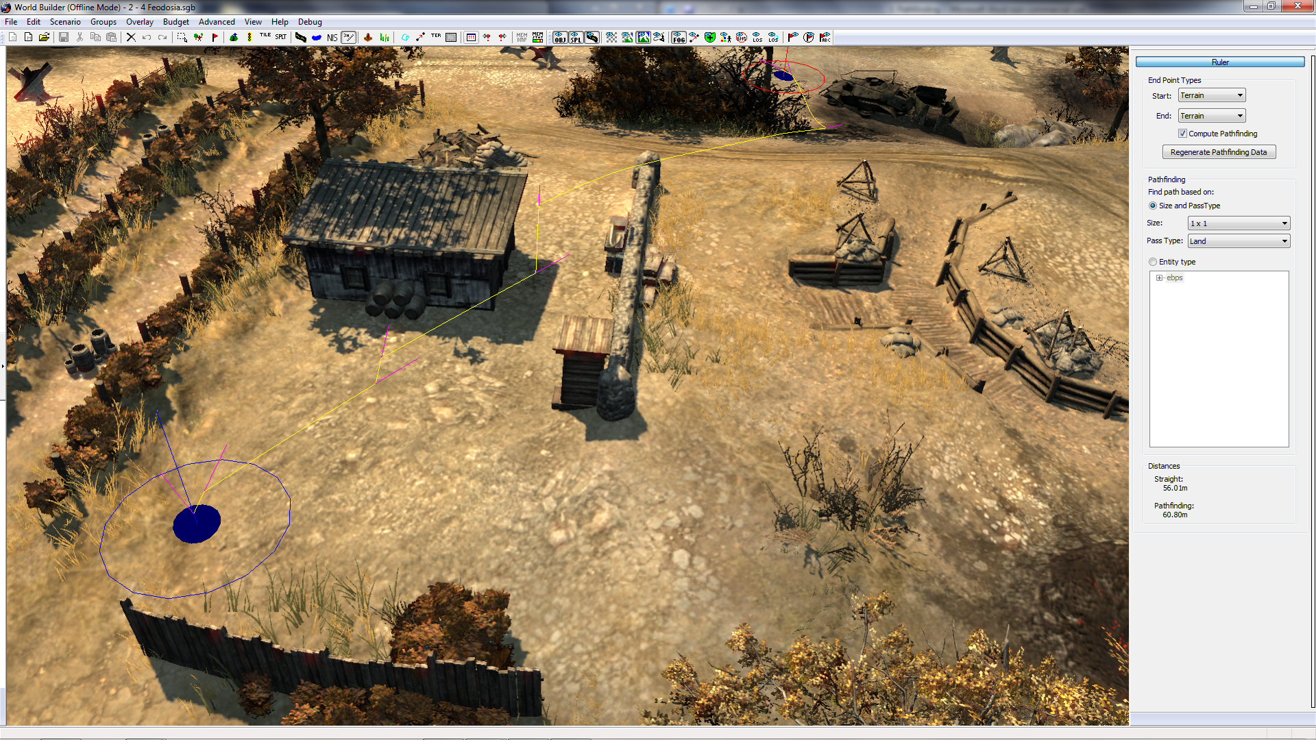
Note that while the line is drawn in yellow, while the unit facing is shown in purple.
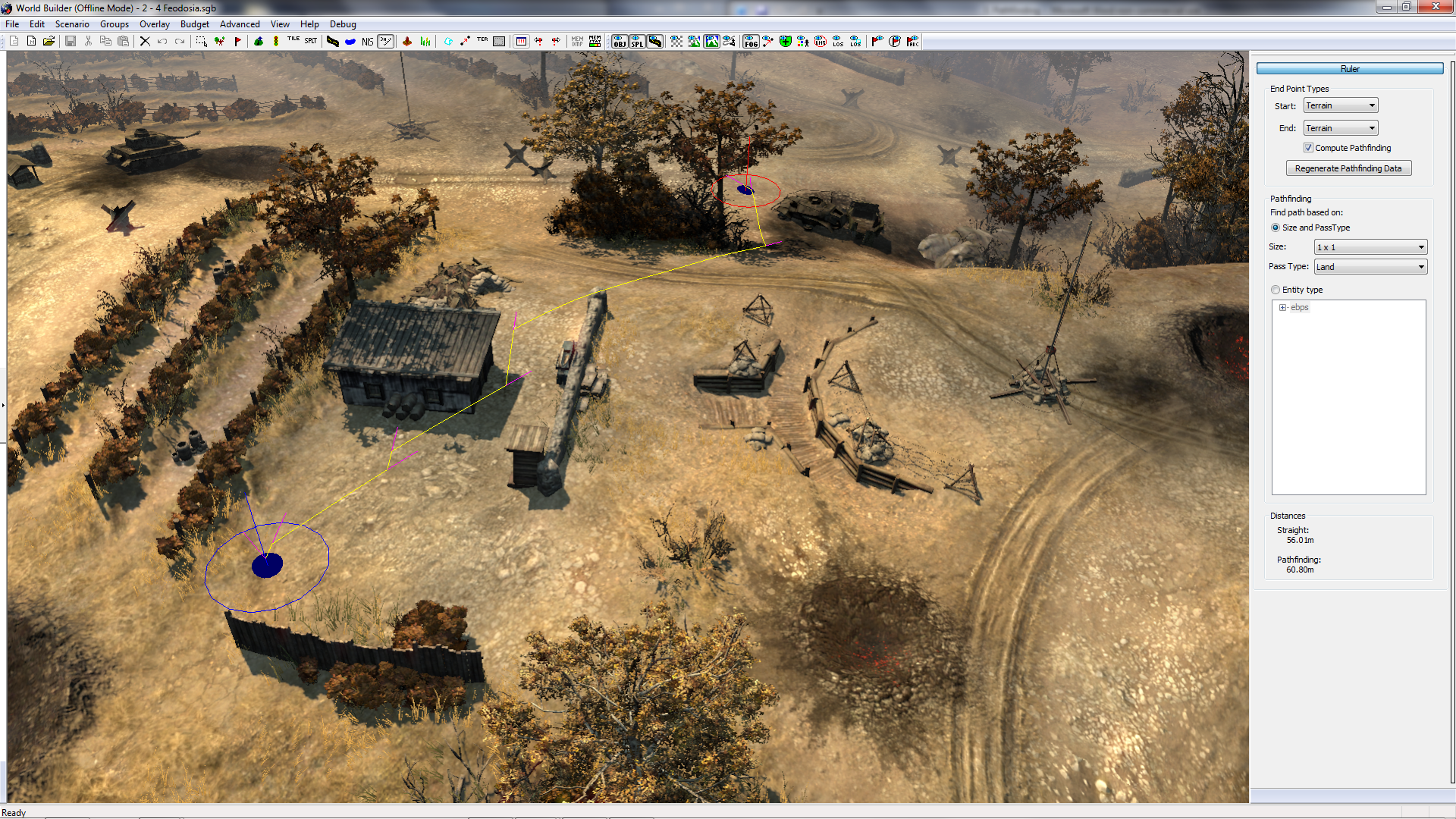
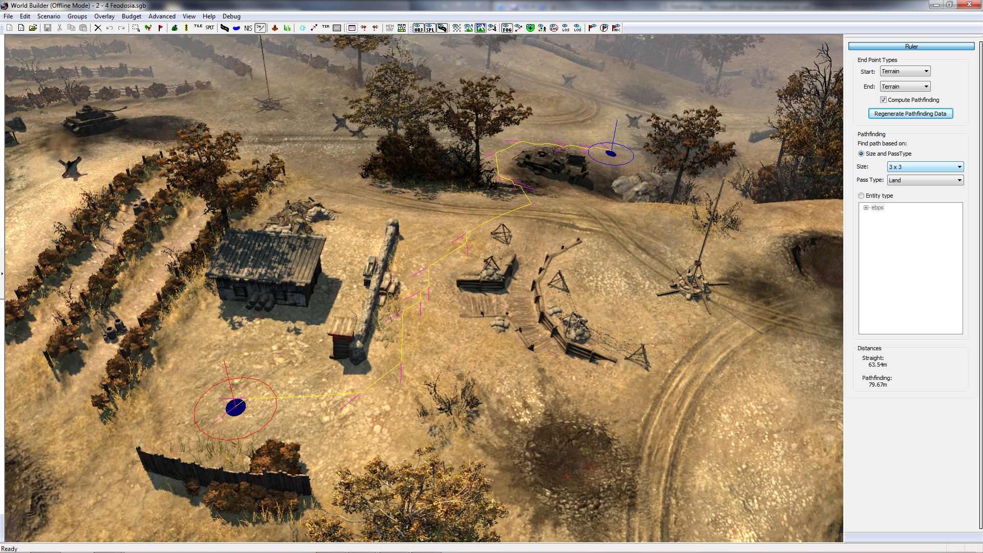
This tool can also be adapted to consider units of different sizes and abilities, but changing the “Size” option under the Pathfinding window. Generally speaking, 1x1 will signify infantry, 3x3 will suit light vehicles and tanks, whereas 5x5 will represent tanks (also taking into consideration their turning circle). If you set new Start and End points, the pathfinding will be regenerated considering the size limitations, showing you clearly where infantry can tread, where tanks can’t (See Figure 6).
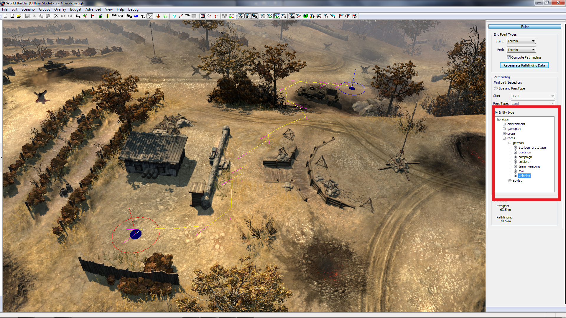
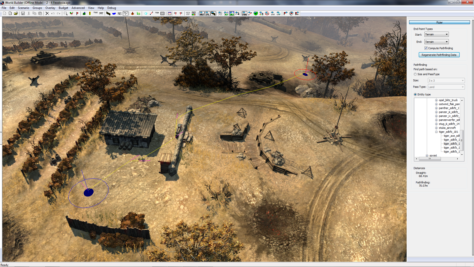
Finally, for a more detailed report, consider changing the “Entity Type” (to allow for vehicles that can crush certain objects), or find an Entity Type, such as:
Use this method to check (and double check if you’re unsure) whether light vehicles and tanks can reach all areas of your map.
We hope this tip was helpful and you check back next week, when we will provide you with a new worldbuilder TotW.
In this week’s TotW we’re looking into Pathfinding, using the Ruler Tool. Although this isn’t a necessary tool, it’s certainly a useful one to use for testing your map before release.

Figure 1
The Ruler Tool, as the name suggests, is used for measuring gaps between objects. By selecting the “Start” and “End” point types as Terrain (See Figure 2), you can left-click on any area of ground one to set a point, and left-click once more to calculate the distance between the two (See Figure 3).

Figure 2

Figure 3
By clicking and dragging the Ruler window down, you will see your results at the bottom of the window, calculated in metres.
Additionally, by checking the “Compute Pathfinding” option, an additional result will be calculated, telling you the quickest distance between the two points (See Figure 4).

Figure 4
With this option selected, there will also be a visual result shown on the map itself, where a line (which otherwise will not be there) will show the route that units will have to take, easily showing you the ideal route that infantry will take from A to B (See Figure 5).

Figure 5
Note that while the line is drawn in yellow, while the unit facing is shown in purple.
This tool can also be adapted to consider units of different sizes and abilities, but changing the “Size” option under the Pathfinding window. Generally speaking, 1x1 will signify infantry, 3x3 will suit light vehicles and tanks, whereas 5x5 will represent tanks (also taking into consideration their turning circle). If you set new Start and End points, the pathfinding will be regenerated considering the size limitations, showing you clearly where infantry can tread, where tanks can’t (See Figure 6).

Figure 6
Finally, for a more detailed report, consider changing the “Entity Type” (to allow for vehicles that can crush certain objects), or find an Entity Type, such as:
Code
ebps/races/german/vehciles/tiger_sdkfz/tiger_sdkfz_181_mp
Use this method to check (and double check if you’re unsure) whether light vehicles and tanks can reach all areas of your map.

Figure 7

Figure 8
We hope this tip was helpful and you check back next week, when we will provide you with a new worldbuilder TotW.


